| 2013 | 2021 | 2013 | 2021 | ||
|---|---|---|---|---|---|
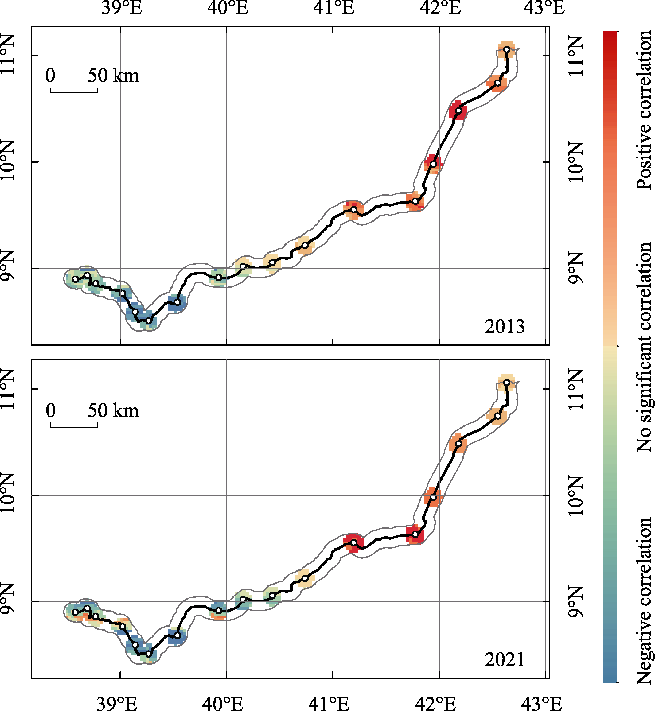
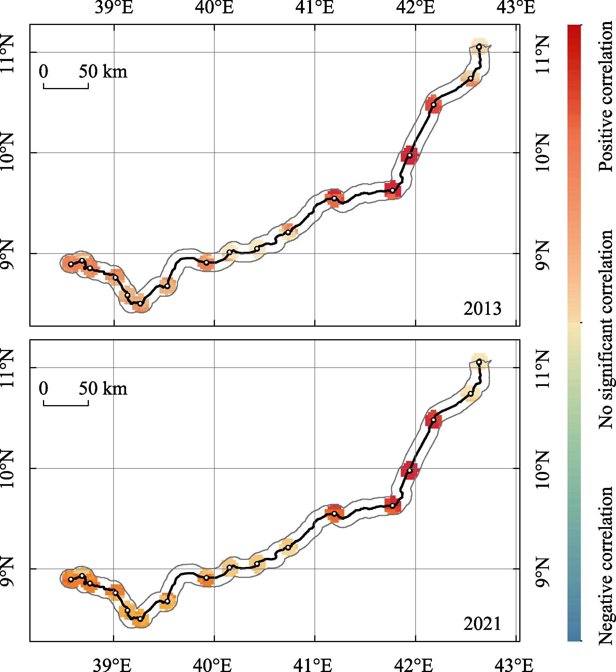
| Distance from the train station | -0.0737** | -0.0487* | Vegetation coverage | -0.0586** | -0.0056 |
| (0.0444) | (0.0821) | (0.0421) | (0.7959) | ||
| Distance from railway line | 0.0082 | -0.0238 | Population size | 0.6386*** | 0.7895*** |
| (0.8198) | (0.3843) | (0.0000) | (0.0000) | ||
| Whether nearby station provides passenger service | 0.1653*** | 0.0831*** | Distance from the central city | -0.2083*** | -0.1314*** |
| (0.0000) | (0.0020) | (0.0000) | (0.0000) | ||
| Whether nearby station provides freight service | -0.1587*** | -0.0641** | Constant | 0.0000 | -0.0000 |
| (0.0000) | (0.0170) | (1.0000) | (1.0000) | ||
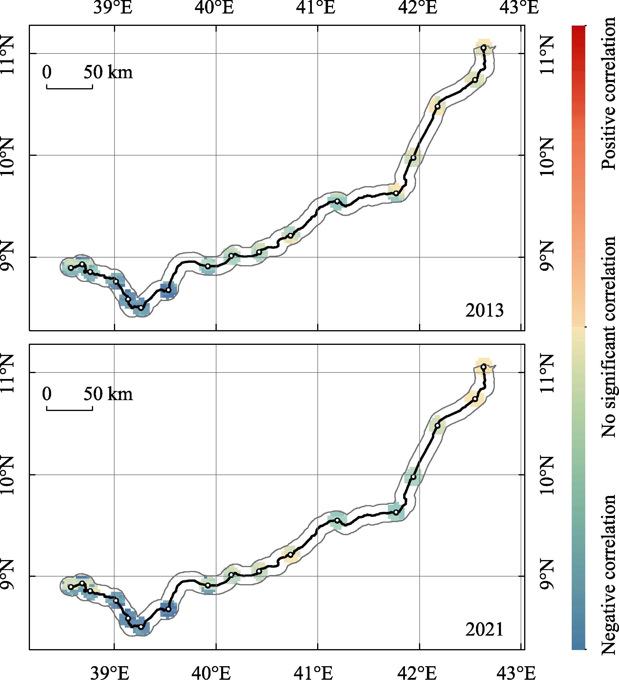
| Slope | 0.0140 | 0.0309 | |||
| (0.6293) | (0.1627) |