| Variable type | Variable category | Variable | Data source |
|---|---|---|---|
| Dependent variable | Built-up land expansion | The proportion of built-up land in the space unit | Land use data |
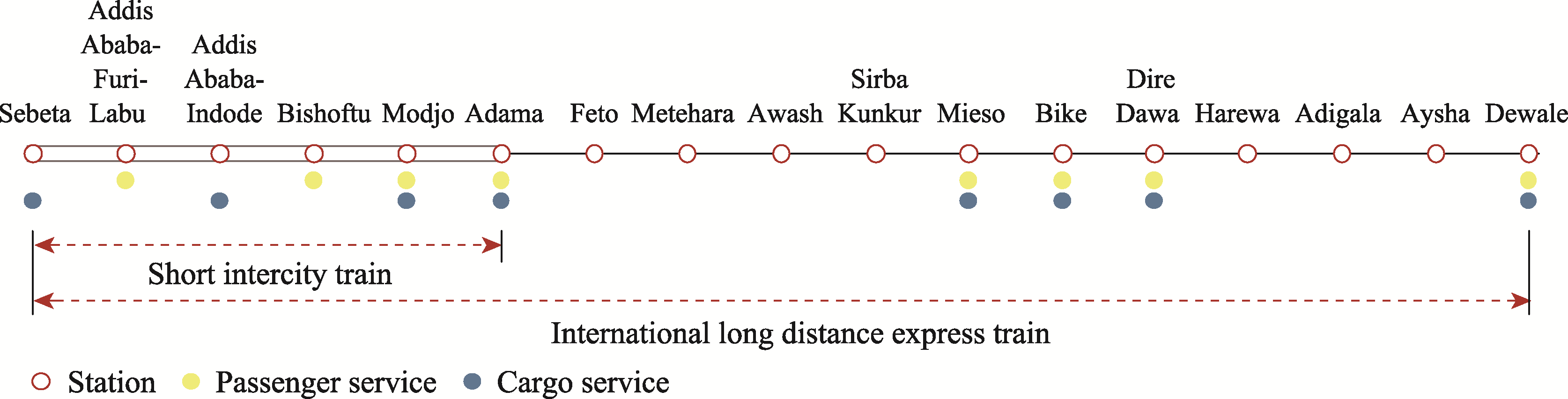
| Explanatory variable | Railway factor | Distance from the train station | Railway station geolocation by Open Street Map |
| Distance from railway line | Railway line shapefile by Open Street Map | ||
| Whether nearby station provides passenger service | Operation strategy of ADR from the ADR Operation and Maintenance Project Company | ||
| Whether nearby station provides freight service | |||
| Natural environmental factor | Slope | DEM | |
| Vegetation coverage | Landsat-OLI | ||
| Social economic factor | Population size | LandScan | |
| Distance from the central city | Central city geolocation |