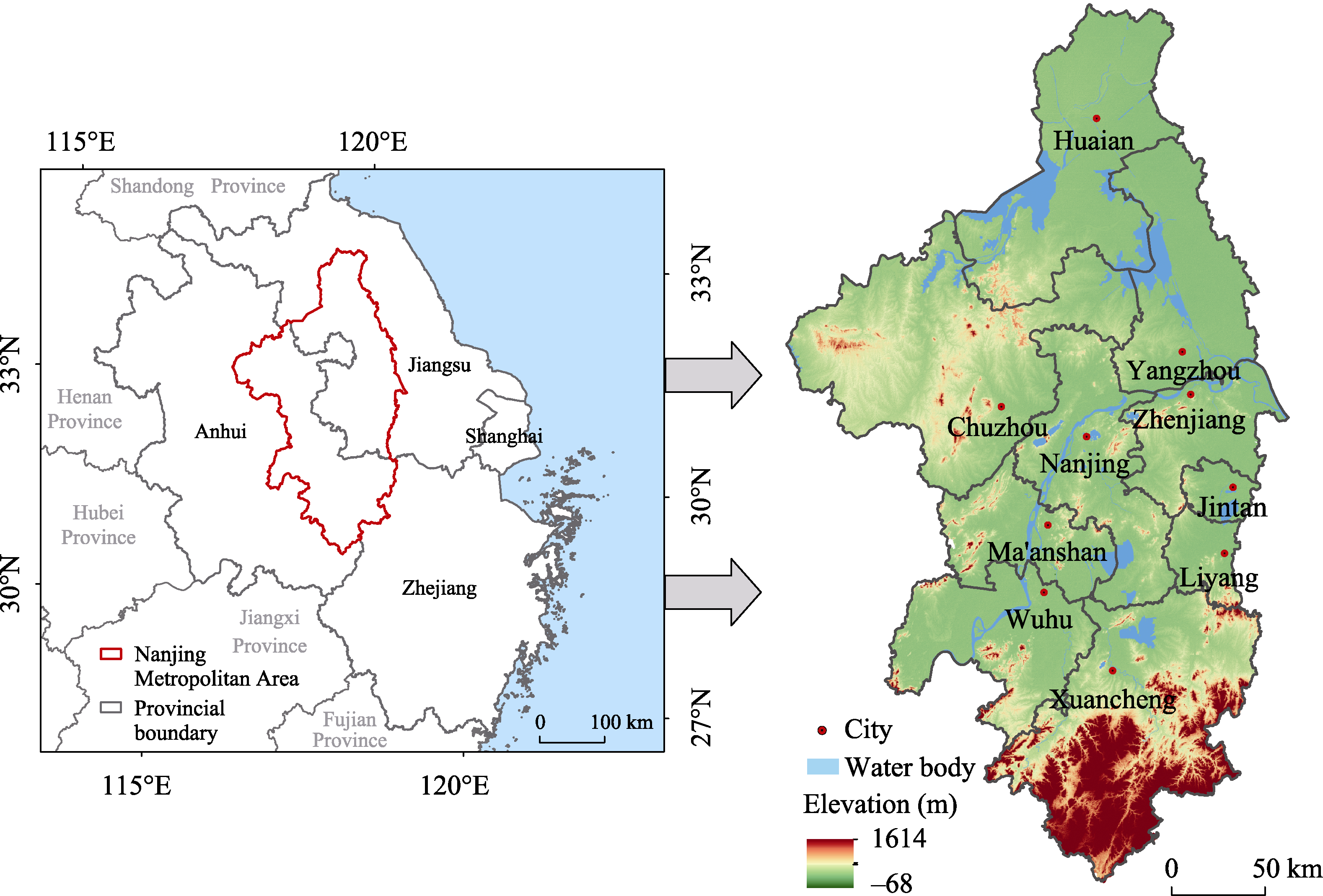
| Indicator type | Standard layer | Indicator layer | Indicator attribute | Indicator description |
|---|---|---|---|---|
| Resource conflict (RC) | Land use conflict (RC1) | Landscape aggregation index (AI) | Negative | Reflect the conflict between farmland resources and built-up land |
| Landscape sprawl index (Contag) | Negative | Reflect the conflict between ecological land resources and built-up land | ||
| Human activities clash with natural resources (RC2) | NPP data | Negative | Reflect the vegetation regeneration capacity | |
| Built-up land density situation reaction | Positive | Reflect the consumption of land resources | ||
| Function conflict (FC) | Supply and demand of ecosystem services conflict (FC1) | Supply of ecosystem services | Negative | Reflect the supply and demand of ecosystem services |
| Demand of ecosystem services | Positive | |||
| Carbon-fixing capacity conflicts with carbon emissions (FC2) | Carbon emissions | Nositive | Reflect carbon emissions and carbon storage | |
| Carbon sequestration | Negative | |||
| Capacity Conflict (CC) | Biodiversity-conflict (CC1) | Habitat quality | Negative | Reflect species richness through biodiversity |
| NDVI data | Negative | Reflect the vegetation coverage situation | ||
| Economic and environmental conflict (CC2) | PM2.5 | positive | CC2=$\frac{GD{{P}_{K}}\times (100-P{{M}_{2.5K}})}{Po{{p}_{k}}}$ Reflect the conflicting relationships between population growth, economic growth, and environmental degradation. (k is the number of the evaluated cells) | |
| Pop | positive | |||
| GDP | positive |