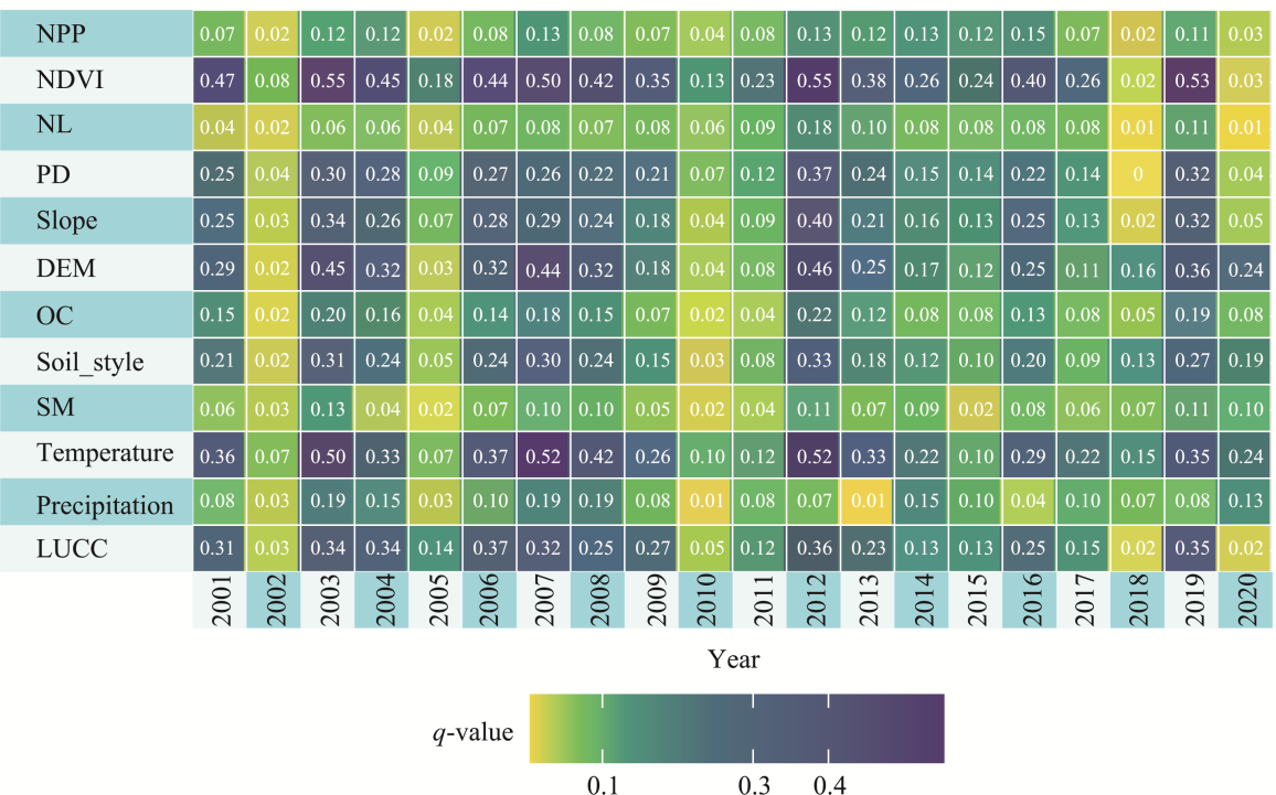
| Data | Resolution | Source | Extracted indicators |
|---|---|---|---|
| MOD09A1 | 500 m | | WET、NDSI |
| MOD11A2 | 1 km | | LST |
| MOD13A1 | 1 km | | NDVI |
| MOD17A3HGF | 500 m | | NPP |
| MCD12Q1 | 500 m | | Land cover types |
| DEM | 1 km | | Slope |
| JRC | 30 m | | Water area |
| Precipitation | 1 km | | / |
| Temperature | 1 km | | / |
| HWSD | 1 km | | Soil type, organic matter |
| Soil moisture | 0.25° | | / |
| Population density | 1 km | | / |
| Nighttime lighting data | 1 km | | / |
Figure 6 Changes in the trend values of climate (a: precipitation; b: temperature) and vegetation (c: Normalized Difference Vegetation Index; d: net primary productivity), corresponding to those of different significant levels in Remote Sensing Ecological Index (NDVI and NPP are the same meaning in
Figure 8 Spatial patterns of the (a) nighttime light trend slopes, (b) corresponding significance levels, (c) interannual variations in basin-mean nighttime light, and (d) nighttime light trend statistics across RSEI change classes (NL: nighttime light). Notably, the dominant class in panel (a) (−0.0005 to 0.0005) represents near-zero trends rather than negative changes; statistical significance is reported in panel (b).