| Name | Source/Dataset | Year | URL/Reference | Description |
|---|---|---|---|---|
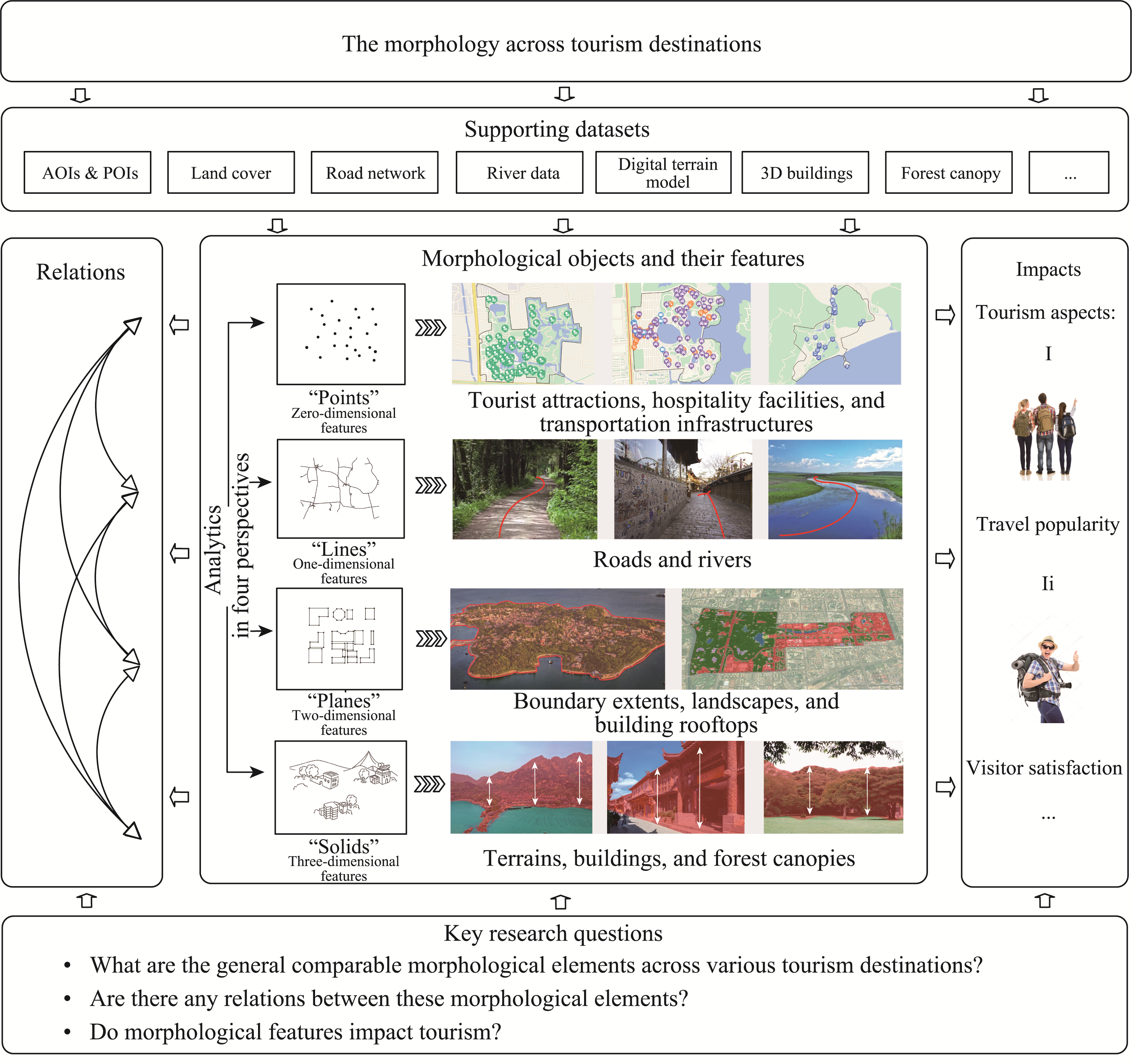
| “Points” | ||||
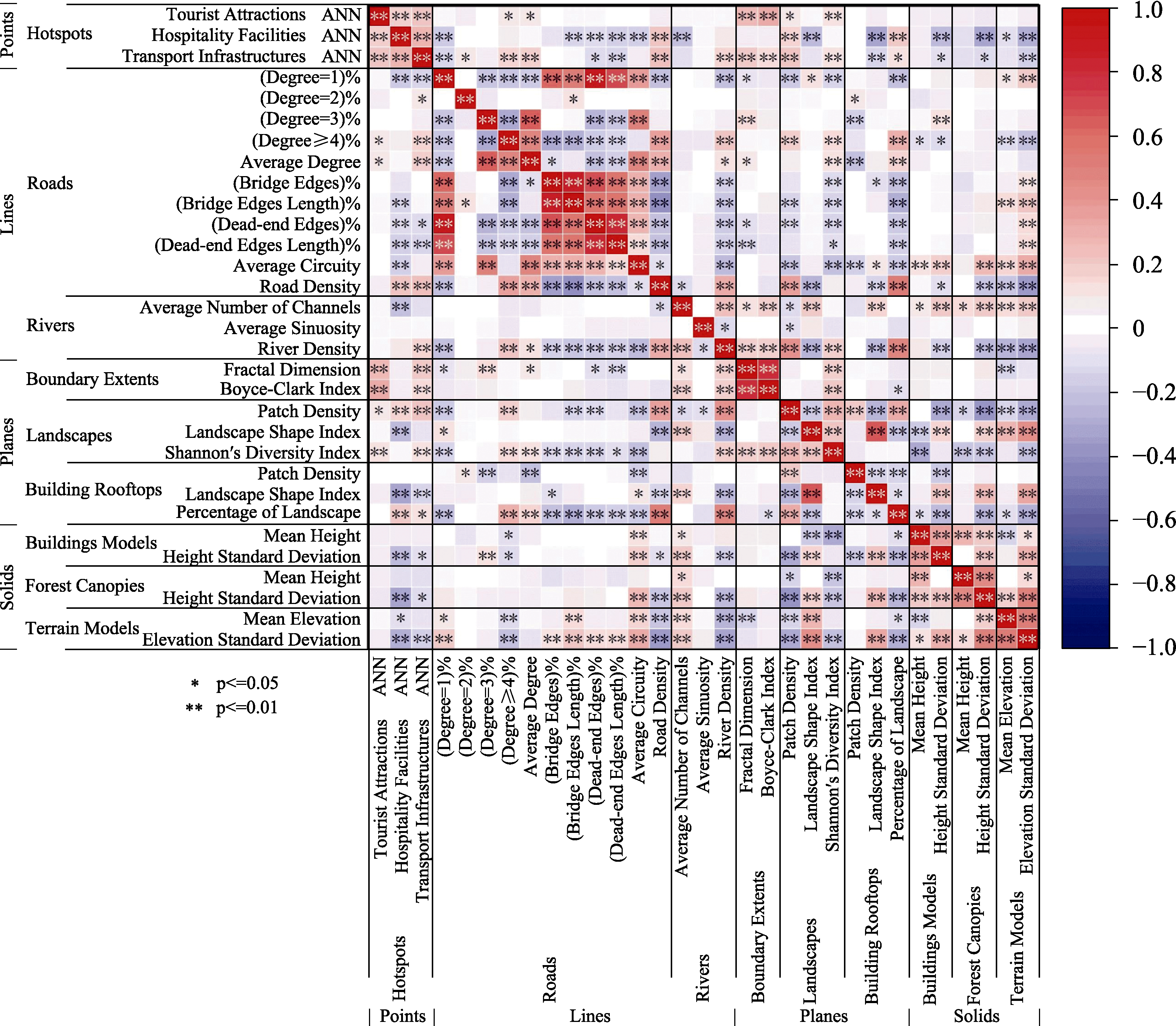
| Points of Interest (POIs) | Gaode Map (Amap) | 2021 | https://www.amap.com/ | Point data that is used to represent a particular place in online maps. POIs of tourist attractions, hospitality facilities, and transport infrastructures are mainly extracted and utilized. |
| “Lines” | ||||
| Road data | Open Street Map (OSM) | 2023 | https://www.openstreetmap.org/ | Line data that is used to represent roads in online maps. |
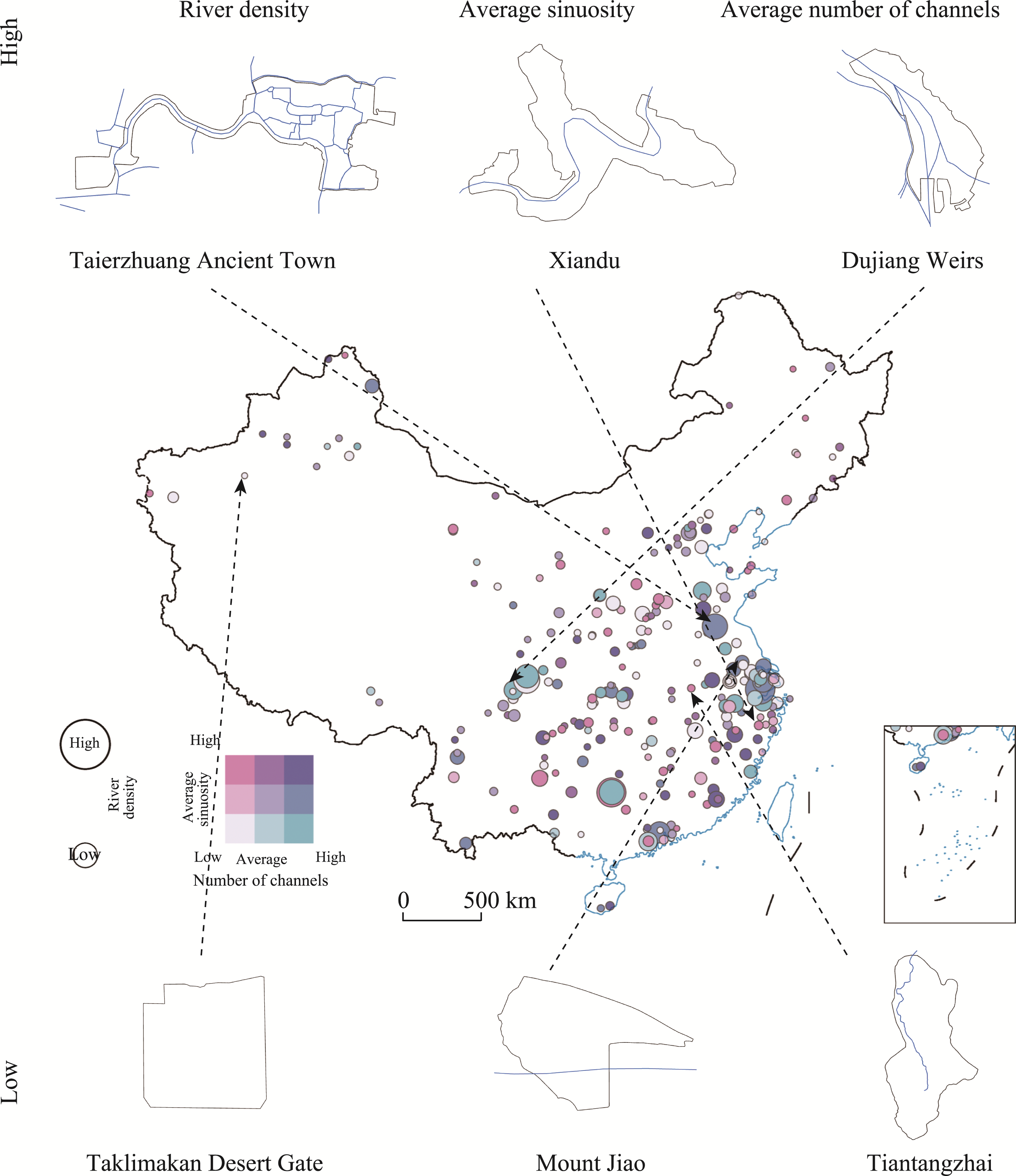
| River data | Open Street Map (OSM) | 2023 | https://www.openstreetmap.org/ | Line data that is used to represent rivers in online maps. |
| “Planes” | ||||
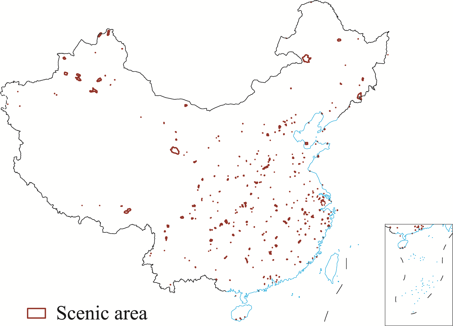
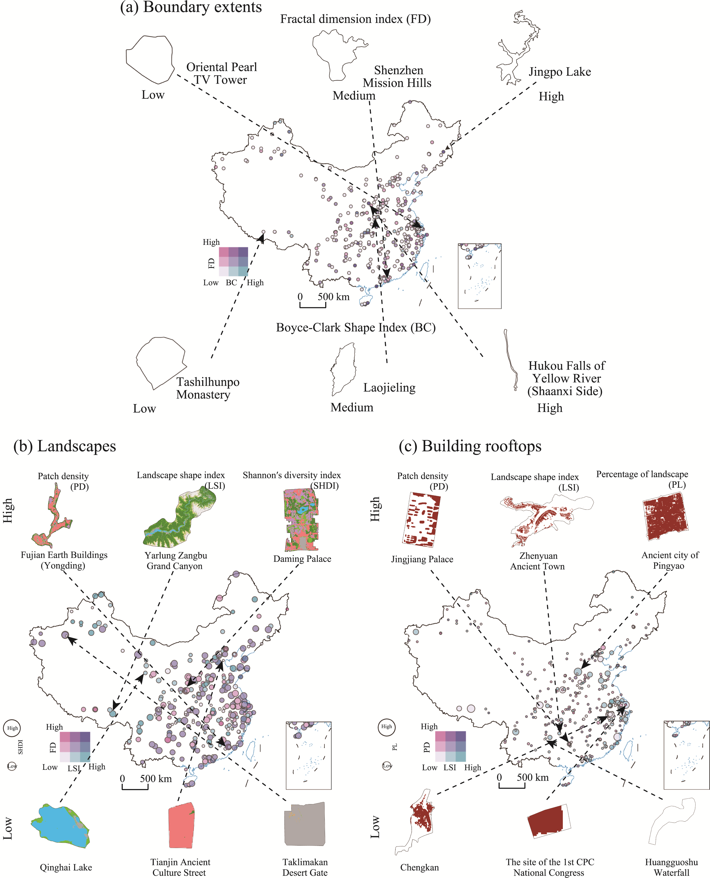
| Areas of Interest (AOIs) | Gaode Map (Amap), Baidu Map (for supplementations), and scenic areas’ official websites (for examinations). | 2022 | https://www.amap.com/ https://map.baidu.com/ | Polygon data that is used to represent the geographical extents of particular places in online maps. AOIs of scenic areas are mainly extracted and utilized. |
| Land Cover | ESA World Cover 2021 | 2021 | Zanaga et al. ( | Land cover data in GeoTIFF format with a 10 m resolution. Landscape patches are defined based on land cover classes (e.g., tree cover, grassland, built-up). The dataset reaches an overall accuracy of 82.1% in Asia. |
| Building Rooftop | Building Rooftop Area Dataset in China (CBRA) | 2021 | Liu et al. ( | Building rooftop data in GeoTIFF format with a 2.5 m resolution. The overall accuracy score exceeds 82 % in urban areas. |
| “Solids” | ||||
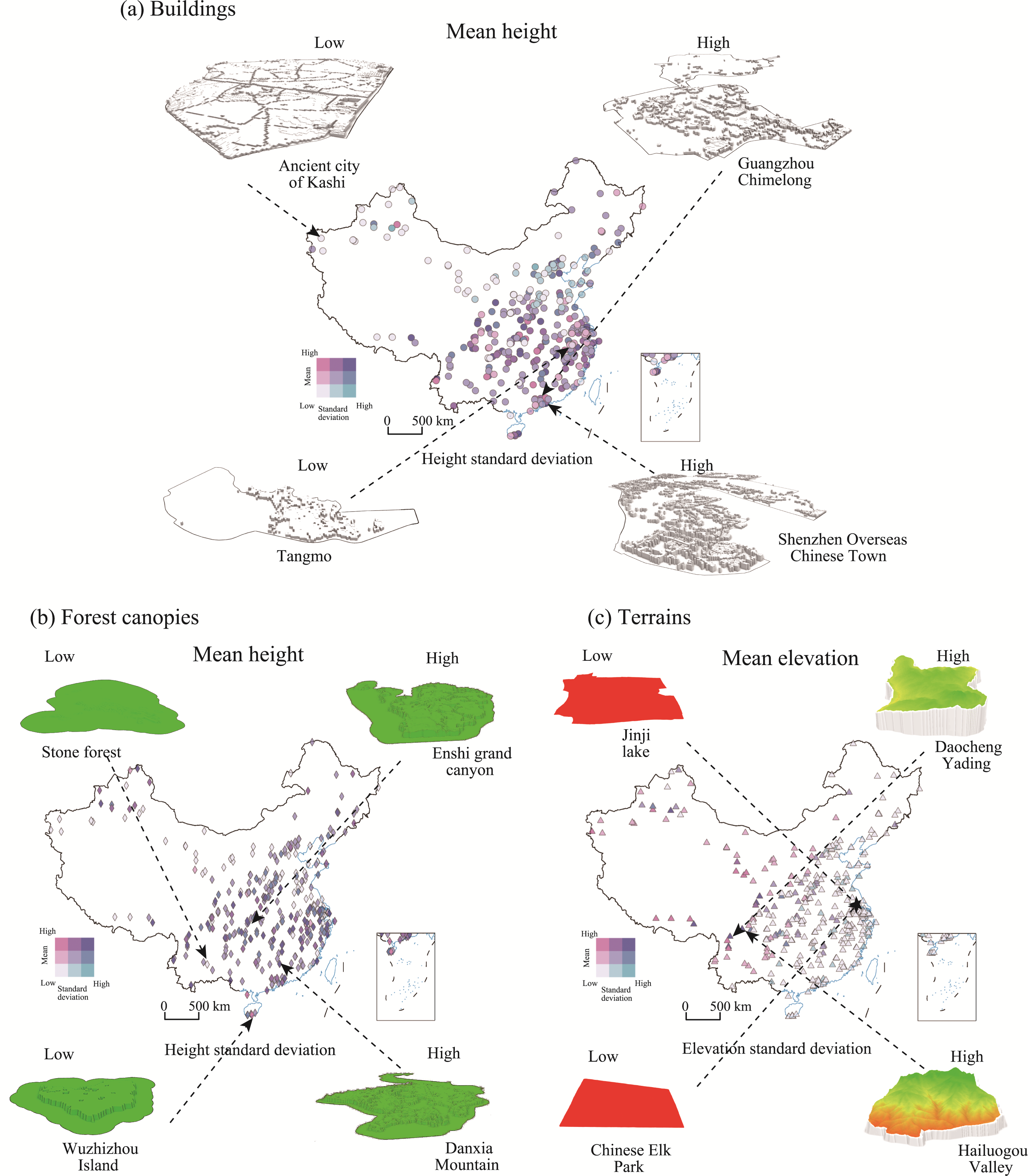
| Building Height | Chinese Building Height (CNBH) | 2020 | Wu et al. ( | Building height data in GeoTIFF format with a 10 m resolution. Estimated and observed building heights exhibit R, RMSE, and MAE values of 0.77, 6.1 m, and 5.2 m, respectively. |
| Forest Canopy Height | Forest Canopy Height Product of China (FCH) | 2019 | Liu et al. ( | Forest canopy height data in GeoTIFF format with a 30 m resolution. Estimated and observed forest canopy heights exhibit R and RMSE values of 0.74 and 4.88m, respectively. |
| Elevation | Forest and Buildings Removed Digital Elevation Model (FABDEM) | 2022 | Hawker et al. ( | Elevation data in GeoTIFF format with a 30 m resolution. The mean absolute vertical error in built-up areas is 1.12 m, and in forests is 2.88 m. |