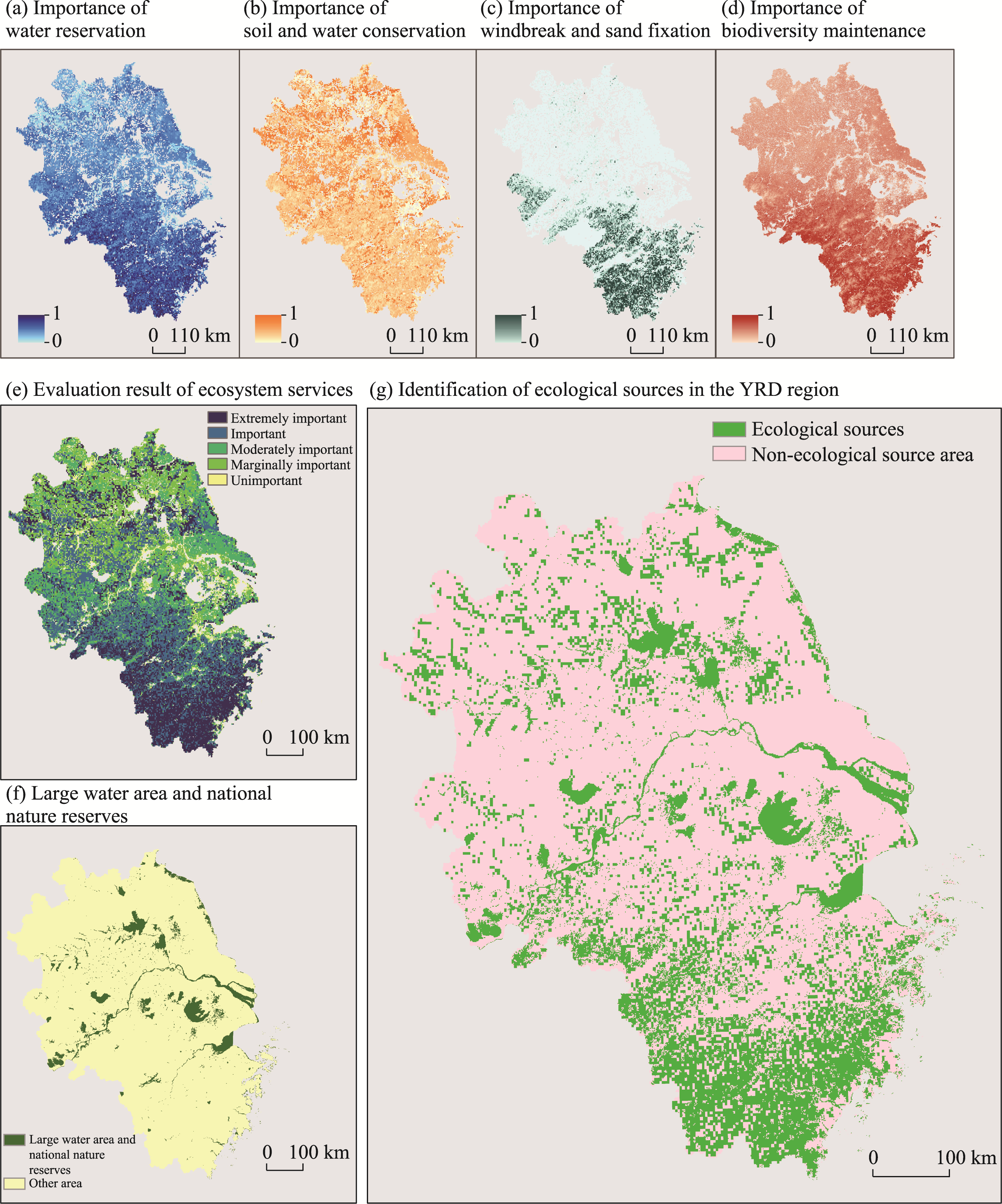
| Type of ecosystem service | Formula | Meanings and sources of parameters involved in calculation |
|---|---|---|
| Water reservation (WR) | $WR=NPP\text{mean}\times Fsic\times Fpre\times (1-Fslo)$ | NPPmean: Multi-year average NPP ( Fsic: Soil seepage (Harmonized World Soil Database, Fpre: Multi-year average precipitation (National Climatic Data Center, ftp://ftp.ncdc.noaa.gov/pub/data/noaa/isd-lite/) Fslo: Slope (Slope analysis of DEM data using ArcGIS 10.8 software) K: Soil erodibility (The calculation method for this indicator can be found in Section SI3 of the Supplementary material) Fq: Multi-year average climate erosivity (The calculation method for this indicator can be found in Section SI3 of the Supplementary material) D: Surface roughness (The calculation method for this indicator can be found in Section SI3 of the Supplementary material) Ftem: Multi-year average temperature (National Climatic Data Center, ftp://ftp.ncdc.noaa.gov/pub/data/noaa/isd-lite/) Falt: Altitude ( |
| Soil and water conservation (Spro) | $Spro=NPP\text{mean}\times (1-K)\times (1-Fslo)$ | |
| Windbreak and sand fixation (SWS) | $SWS=NPP\text{mean}\times K\times Fq\times D$ | |
| Biodiversity maintenance (Sbio) | $Sbio=NPP\text{mean}\times Fpre\times Ftem\times (1-Falt)$ |