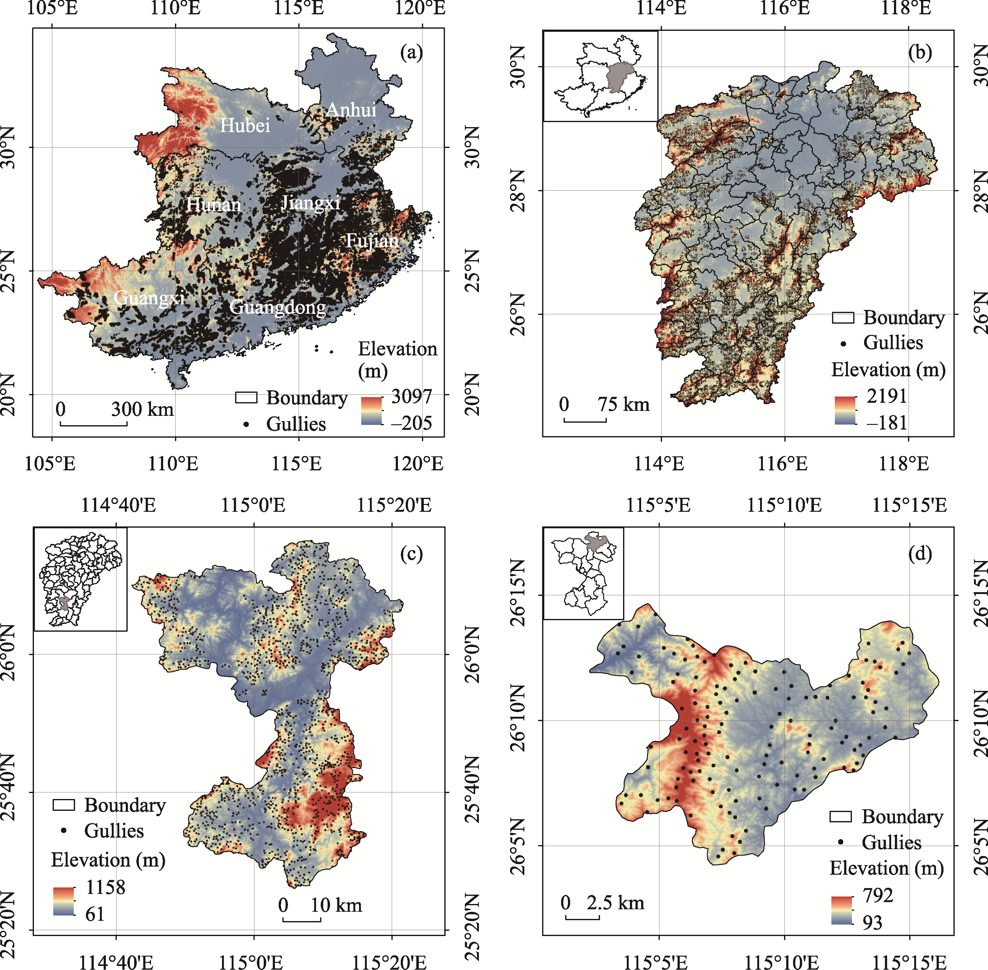
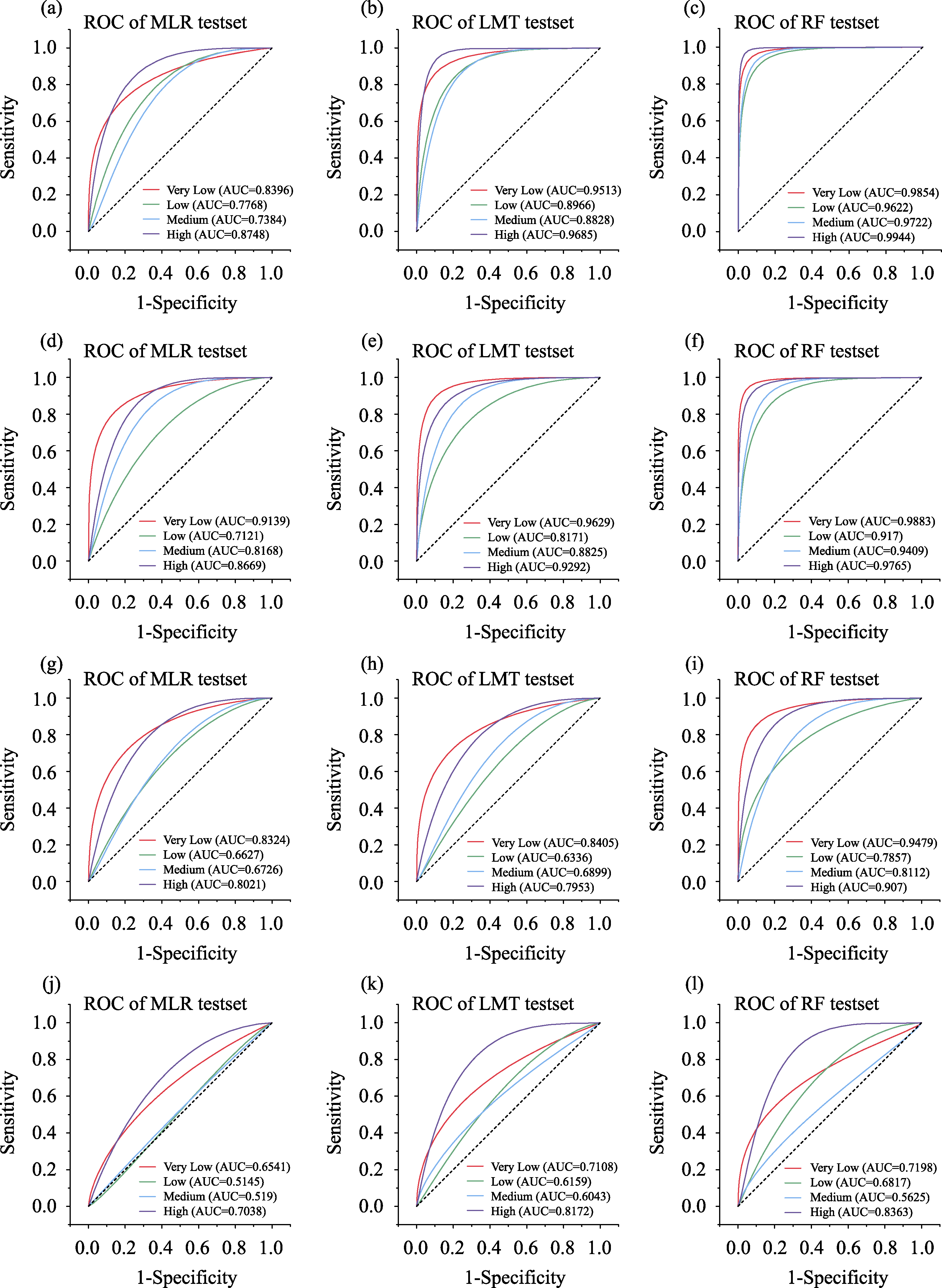
| Site | Latitude/longitude | Area (km2) | Elevation (m) | Mean annual temperature (℃) | Mean annual precipitation (mm) | Gullies | Gully area (km2) |
|---|---|---|---|---|---|---|---|
| Southern China | 20°13′-34°38′N, 104°28′-120°40′E | 1,241,500 | -205-3097 | 14-24 | 754.5-2312.3 | 23,9125 | 1220 |
| Jiangxi province | 24°29′-30°05′N, 113°34′-118°29′E | 166,900 | -181-2191 | 16.3-19.5 | 1341-1943 | 48,058 | 207.40 |
| Ganxian county | 25°26′-26°17′N, 114°42′-115°22′E | 2993.09 | 61-1158 | 16.3-20.5 | 1600.5-1700 | 4138 | 18.1 |
| Tiancun township | 26°04′-26°14′N, 115°02′-115°16′E | 222.21 | 93-792 | 17.2-19.8 | 1622.8-1682.1 | 590 | 1.69 |